Arun Valley Trek
Duration
15 Days
Max Altitude
3,360 m. / 11,024 ft.
Difficulty
Easy
Group Size
2-16 Pax
Meals
- 13 Breakfast
- 12 Lunch
- 13 Dinner
Accommodation
- Hotel
- Lodge
- Teahouse
Transportation
Flight/Car/Jeep
Activities
- Travelling
- Sightseeing

- Your safety, our no 1 priority
- Best price guarantee
- Experienced & dedicated team
- Easy booking, no hidden charge
- You can customize this trip

Talk to Travel Expert Samundra Rimal (+977-9843127084)
Introduction of Arun Valley Trek
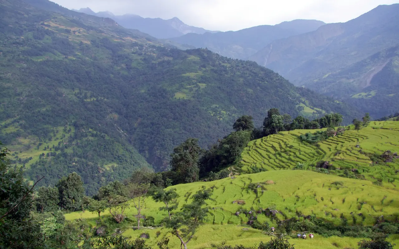
The Arun Valley Trek is a unique and rewarding trekking experience in eastern Nepal, ideal for travelers who want to explore a remote region far from crowded tourist trails. This trek takes you to the picturesque valley of Arun, which is characterized by diverse, beautiful landscapes in nature, traditional villages, and rich cultural heritage. The Arun Valley Trek is a peaceful route, unlike the other popular trekking routes, where trekkers can fully experience nature and the life of the people.
It starts in the low hills at Tumlingtar and moves along the banks of the Arun River, through hot valleys, agricultural land, and small rural villages. The scenery is gradually altered as the trail moves on.
You pass through terraced fields, subtropical forests, bamboo groves, and later into cooler hills with rhododendron and pine trees. The route goes through the villages where Rai and Limbu communities are still practicing traditional ways of life in farming. Such cultural experiences form one of the significant points of interest of the Arun Valley Trek and provide trekkers with an additional attachment to the area.
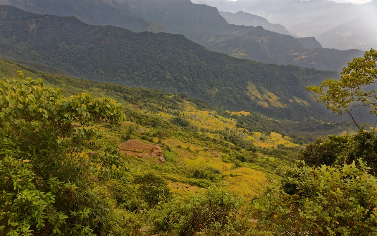
The higher you go, the more adventurous the trek. The trail is constantly ascending to Salpa Pass, the peak of the trip at 3,360 m / 11,025 ft., where you will feel a sense of accomplishment and see the surrounding hills and far Himalayan mountains.
This trail then winds down through forested ridges into the Sherpa villages, where Tibetan Buddhism is more pronounced with prayer flags, chortens, and monasteries.
The Arun Valley Trek is regarded as moderately difficult. The time spent walking is easy enough to manage daily, and the gradual uphill progress assists in acclimatization. This renders this trek a good choice among those beginners who are fit enough or those who have had experience in trekking and enjoy the off-the-beaten-path adventure. Local teahouses are basic yet friendly and cozy to stay overnight.
The Arun Valley Trek ends at Lukla, the entry point of the Everest region, which forms a rewarding linkage between two quite contrasting trekking sceneries. During the journey, the trekkers have the pleasure of peaceful trails, a variety of scenery, and authentic culture.
Arun Valley Trek is well planned with Nomad Adventure Treks giving it proper guides, good logistical support, and complete assistance to make sure that the Himalayan trekking adventure is safe, enjoyable, and memorable.
Trip Highlights
- Hike in some of the least-traveled areas of Nepal and have a quiet and untouched trail.
- Learn about the local culture in Rai, Limbu, and Sherpa villages and their traditional ways of life.
- Walk through warm river valleys and cool mountain forests, with the thrilling effects that a change of scene presents.
- Cross scenic Salpa Pass at 3,360 m (11,025 ft), the peak and most rewarding point of the journey.
- Traverse beautiful rhododendron woods, terraced agriculture, and remote mountainous terrain.
- Join the isolated Arun Valley with the well-known Everest area, completing the trek at Lukla.
Detail Itinerary of Arun Valley Trek
Day 01: Arrival in Kathmandu (1,350 m / 4,430 ft)
Welcome to Nepal! You land in Kathmandu, the capital city of Nepal, at 1,350 m / 4,430 ft above sea level. You will be received warmly by the representative of Nomad Adventure Treks after landing at the Tribhuvan International Airport. You will then be taken to your hotel that would be approximately 30 minutes by private transport. Once you check in, you are able to rest and refresh yourself after a long international flight.
In case you are energetic, you might go strolling around the surrounding streets, particularly Thamel, a busy area where there are shops, cafes, and trekking shops. It is an opportunity to purchase any last-minute trekking equipment or souvenirs.
During the evening, the hotel will have a brief welcome and orientation meeting. Your guide will explain the plan of the Arun Valley Trek, review safety details, inspect your equipment during this time, and respond to any questions.
You will stay in a nice hotel and have a good sleep before your journey.
Activity: Arrival & orientation, 30 minutes ride
Max. Altitude: 1,350m/4,429ft. Kathmandu
Meal: Dinner
Accommodation: Hotel
Day 02: Fly from Kathmandu to Tumlingtar (410 m / 1,345 ft)
You will take a scenic flight after an early breakfast from Kathmandu domestic airport to Tumlingtar. Its duration is approximately 45 minutes and has wonderful scenery of hills, rivers, and the mountains in the distance. It is a huge difference in scenery and weather as the plane lands. At 410 m / 1,345 ft, far below Kathmandu, it is warmer at Tumlinghar.
On reaching there, you will see your other trekking crew, such as the porters and assistants. Also, there is a short walk or drive to your lodge from the airport.
The afternoons are free, where you can either relax or sightsee in the local market area. Tumlinghar is a small town and acts as the access point to the Arun Valley.
Your guide will provide a thorough briefing of the days to come, as far as trekking is concerned, in the evening. On this day, you will have an initial dinner in the eastern part of Nepal and a place to stay in a local lodge, where you will be prepared to start trekking the following day.
Activity: Travel by air, 45 minutes flight
Max. Altitude: 410m/1,345ft. Tumlingtar
Meal: Breakfast, Lunch, Dinner
Accommodation: Lodge
Day 03: Trek from Tumlingtar to Chiyabesi (280 m / 920 ft)
This day marks the beginning of a trek to the Arun Valley. Then, leaving Tumlingtar, the road goes down moderately along the broad valley of the Arun. It is a good walk and has fertile farmlands, small villages, and terraced fields. You pass settlements such as Giddhe and Satighat on your way, situated at about 500 m / 1,640 ft, where the local people live in a traditional rural way of life.
The path takes up the Arun River, which is the major part, and can enable you to see the flowing water, the green river banks, and the hills around it. Since the region is low altitude, the climate is hot and humid, particularly in the middle of the day. One may find farmers in their fields cultivating rice, millet, and vegetables.
After 5-6 hours of walking, you come to the village of Chiyabesi, a small village on the riverbank, at 280 m / 920 ft. You spend the night in a small teahouse. When the evening comes, do not be stressed and listen to the peaceful river sound and rest for the night after a fulfilling dinner.
Activity: Trekking, 5–6 hrs hiking
Max. Altitude: 500m/1,640ft. Chiyabesi
Meal: Breakfast, Lunch, Dinner
Accommodation: Teahouse
Day 04: Trek from Chiyabesi to Tabular (600 m / 1,970 ft)
You then walk on the Arun Valley after breakfast, and the trail slowly ascends to the west. Leaving the river, you enter cooler and greener hills. This elevation relief is a relief of the lower valley heat. On the road, you cross Kattike at approximately 500 m / 1,640 ft and cross the Irkhuwa Khola valley.
The landscape is further diversified, including the sal forests, terraced agricultural plots, and hillside villages. You traverse through villages like Majhuwa and Chalise, where you can witness the daily life and socialize with the amiable locals. The path is constantly ascending, but not too difficult, and there are frequent pauses.
Towards the end of the afternoon, you reach Tabular, a small village at 600 m / 1,970 ft. At this point, you would have the beauty of the hills and valleys around you. Having had an excellent dinner at the teahouse, you rest in bed and look forward to an even more mountainous journey over the next few days.
Activity: Trekking, 5–6 hrs hiking
Max. Altitude: 600m/1,969ft. Tabular
Meal: Breakfast, Lunch, Dinner
Accommodation: Teahouse
Day 05: Trek from Tabular to Dobhane (1,800 m / 5,905 ft)
This day’s walk is characterized by an appreciable climb in altitude. Leaving Tabular, it crosses the Pikhuwa Khola stream by wooded tracks and by little clearings. In several hours, you arrive at Gotte Bazaar, a local trading village 800 m (2,625 ft).
Here you will cross another suspension bridge on the Benkhuwa River, after which you will keep climbing the hill. The path crosses Negdaha with its terraced fields and farmlands on the hill. As the altitude increases, the temperature drops, and gradually the vegetation transforms into a temperate forest as opposed to a subtropical forest.
In 5-6 hours of constant walking, you reach Dobhane, which is located at 1,800 m / 5,905 ft. The village is near a river junction, hence the name Dobhane means two rivers. You spend the night in a simple teahouse, where you can relax in the peaceful mountain environment.
Activity: Trekking, 5–6 hrs hiking
Max. Altitude: 1,800m/5,906ft. Dobhane
Meal: Breakfast, Lunch, Dinner
Accommodation: Teahouse
Day 06: Trek from Dobhane to Salpa Phedi (1,565 m / 5,135 ft)
On leaving Dobhane after breakfast, follow a trail that is a branch of the Great Himalaya Trail. It is a more secluded and scenic road over thick woods, across little brooks on farm bridges. The deeper you go into the hills, the fewer are the villages.
You cross Dongche, then go on to Tendo at approximately 1,475 m / 4,840 ft. The mixed ethnic communities in these villages reside, and you might begin to perceive the influence of a culture in the higher mountain areas. The road gets into a gradual rise, and the forest environment is calm.
In the afternoon, you reach Salpa Phedi at 1,565 m / 5,135 ft, that is, the base of Salpa Pass. This is a small settlement that is located below the Salpa Bhanjyang. The air is colder here, and the surrounding is more prominent. You sleep in a plain lodge after a warm dinner.
Activity: Trekking, 5–6 hrs hiking
Max. Altitude: 1,565m/5,135ft. Salpa Phedi
Accommodation: Teahouse
Day 07: Trek from Salpa Phedi to Guranse (2,990 m / 9,810 ft)
It is a difficult and good day today, as you are making your way over Salpa Pass. You begin early, and you make your way up on the Salpa Phedi, through dense woods of rhododendron, oak, and bamboo. The path steadily rises in height, and you walk slowly to acclimatize yourself to the thin air.
In the spring, the rhododendron woods are particularly pretty, and the hillsides are overgrown with red and pink flowers. After some hours of climbing through the forest, the forest starts thinning, and the views become open. With the increase in altitude, the temperature decreases.
Before the afternoon, you arrive at Guranse, at 2,990 m / 9,810 ft. The word Guranse signifies rhododendron, and it suits the environment perfectly well. This isolated location is simple and has a tranquil mountain environment. After a long day, you sleep well and get ready for the next day.
Activity: Trekking, 5–6 hrs hiking
Max. Altitude: 2,990m/9,810ft. Guranse
Meal: Breakfast, Lunch, Dinner
Accommodation: Teahouse
Day 08: Trek from Guranse to Sanam via Salpa Pass (3,360 m / 11,025 ft)
This is one of the most thrilling days of the trek, with the crossing of Salpa Pass, which is the highest point of the journey. The trail ascends through forest and open meadow, staying persistent after breakfast in Guranse at 2,990 m / 9,810 ft.
A couple of hours up the mountain, you arrive at Salpa Pass at 3,360 m / 11,025 ft. A big Buddhist chorten and some colorful prayer flags make the pass have a serene and spiritual environment.
Weather permitting, you will have the distant Himalayan mountains visible as you go through the pass. At a height of 8,481 m / 27,825 ft, Makalu is occasionally visible to the east.
The trail starts a long descent to the other side after sightseeing and taking pictures. It winds down at different points and through clouds and foggy forest with trees and birds.
You cross the little town of Dhaka at 2,676 m / 8,780 ft on the way down. Towards the end of the afternoon, you reach the Sherpa village of Sanam, which is at 2,600 m / 8,530 ft. Having a warm meal and a rest after this huge day on the mountain is particularly gratifying.
Activity: Trekking, 5–6 hrs hiking
Max. Altitude: 3,360m/11,024ft. Salpa Pass
Meal: Breakfast, Lunch, Dinner
Accommodation: Teahouse
Day 09: Trek from Sanam to Bung (1,800 m / 5,905 ft)
It is a long and physically tiring day with numerous ups and downs during the Arun Valley Trek. At 2,600 m / 8, 530 ft, the trail continues from Sanam, then ascends slowly and then falls abruptly into the Hongu Khola river. On the other side of the river, you start another mountain walk through the wooded hills and terraced agricultural fields.
In the middle of the day, you arrive in the village of Guquel of the Rai community at approximately 1,970 m / 6,460 ft. It is a village where one can have a glimpse of Rai culture, traditional houses, agriculture, and hospitable people. The trail then takes a brief break, and then descends once more, after which it once again climbs over ridges and through dark little lanes.
The day is tough due to the continual variations in elevation, but satisfying due to the scenery. You go through woods, little brooks, and a broad valley prospect. It takes you till the end of the afternoon to reach Bung, a big village at 1,800 m / 5,905 ft.
Bung is an area with many green terraced fields and is dominated by the Rai community. You check into a teahouse and have a well-deserved rest after one of the hardest days of the journey.
Activity: Trekking, 6–7 hrs hiking
Max. Altitude: 2,000m/6,562ft. Bung
Meal: Breakfast, Lunch, Dinner
Accommodation: Teahouse
Day 10: Trek from Bung to Gaikharka (2,500 m / 8,200 ft)
The day is less demanding than yesterday, but it will include constant walking. When you leave Bung at 1,800 m / 5,905 ft, the trail walks along the forested hillsides following smooth curves. It ascends slowly to Khiraule, a village at 2,400 m / 7,875 ft with a small monastery. It is a nice place to sleep and have the quiet mountain view.
In Khiraule, the path once more mounts to Surkhe Ridge with the peak of the day at 3,085 m / 10,120 ft. The ascent is not very rapid yet comfortable, going through pine and rhododendron forests. On the peak, there is a view of the Inkhu Khola valley and hills.
Once on the ridge, the road winds down after a period of one and a half hours, via forest trails. By afternoon, you are already at Gaikharka (2,500 m / 8,200 ft). It is a small settlement where animals are mostly grazed in summer. There are a few houses, and the surroundings are not that noisy, which makes it a peaceful place to rest at night.
Activity: Trekking, 5–6 hrs hiking
Max. Altitude: 3,085m/10,121ft. Surkhe Ridge
Meal: Breakfast, Lunch, Dinner
Accommodation: Teahouse
Day 11: Trek from Gaikharka to Pangom (2,846 m / 9,340 ft)
One of the steepest climbs of the trek is included today. You start with a descent of Gaikharka at 2,500 / 8,200 ft down to the river Inkhu Khola. Once across the river, the trail at once ascends steeply upwards. The trail is across wood and open slopes, causing the climb to be slow and heavy.
With height, the vegetation becomes less dense than the forest and becomes shrubs and grassy ridges. The peak of the day is around Pangom La, which is at approximately 3,350 m / 11,000 ft, and you are rewarded with panoramic views of the adjacent hills and valleys. The road leads down to the town of Pangom after a rest.
Pangom is a beautiful Sherpa village with an altitude of 2,846 m / 9,340 ft. The village is a renowned village with Hillary School, which was constructed with the assistance of Sir Edmund Hillary. Enhanced with the Buddhist influences, you will find prayer flags, chortens, and the peaceful village atmosphere. You spend the night in a teahouse and sleep after a tiring but satisfying day.
Activity: Trekking, 6–7 hrs hiking
Max. Altitude: 3,350m/10,991ft. Pangom La
Meal: Breakfast, Lunch, Dinner
Accommodation: Teahouse
Day 12: Trek from Pangom to Puiyan (2,640 m / 8,660 ft)
You follow a part of the classic Everest Base Camp trail after breakfast in 2,846 m / 9,340 ft Pangom. The path takes one to Kharte 2,830 m / 9,285 ft at a small settlement where lodges are located along the primary trekking route.
Kharte leads up to the Khari La Pass at 2,840 m / 9,320 ft. It is not as strenuous as the previous passes, and there are nice landscapes of hills and far mountains. Having lunch at the pass, the trail leads downwards slowly, then there are some slight ups and downs.
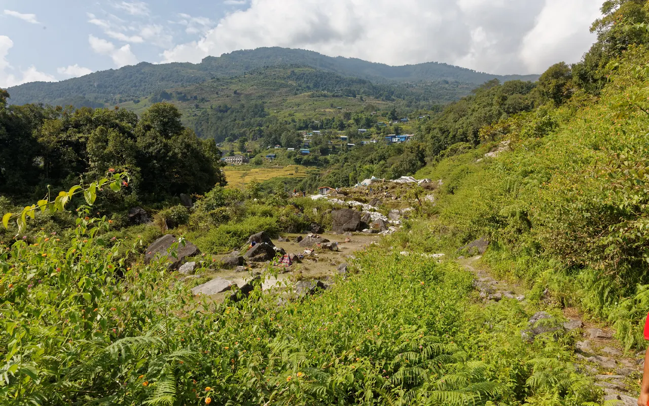
There are likely to be more trekkers, porters, and pack animals as the trail is more frequented than the trails in the Arun Valley. Mid-afternoon, you reach Puiyan, 2,640 m / 8,660 ft., where there are a few teahouses, little shops, and more facilities. You spend a good night here, and you are sure that tomorrow is the last day of trekking.
Activity: Trekking, 6–7 hrs hiking
Max. Altitude: 2,840m/9,318ft. Khari La Pass
Meal: Breakfast, Lunch, Dinner
Accommodation: Teahouse
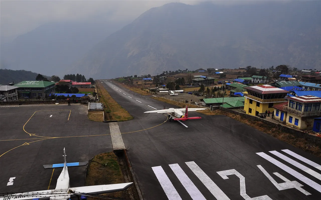
Day 13: Trek from Puiyan to Lukla (2,860 m / 9,385 ft)
It is the last day of the trek. At 2,640 m over 8,660 ft / Puiyan, you leave a broad and well-trodden path through woody hills. The route consists of moderate ups and downs, which makes the walk pleasant. On the path, there are mani stones, prayer flags, and small stupas, which indicate the high Buddhist culture of the area.
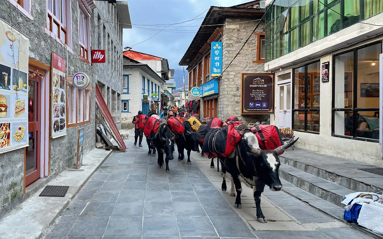
The trail passes across streams and pine forests and then comes into Lukla. The closer you are, the more trekkers and lodges there are. In the early afternoon, you reach Lukla at 2,860 m / 9,385 ft, where the famous mountain airstrip is located.
Once you have checked into your lodge, you can relax, have a hot shower, or wish your trekking crew happy times. It is one to look back at how you have travelled through the low Arun Valley to the Everest region. You have a final dinner with guides and porters in the evening, in recognition of the successful accomplishment of the trek.
Activity: Trekking, 4–5 hrs hiking
Max. Altitude: 2,860m/9,383ft. Lukla
Meal: Breakfast, Lunch, Dinner
Accommodation: Lodge
Day 14: Fly from Lukla to Kathmandu (1,350 m / 4,430 ft)
You get up early in Lukla at 2,860 m / 9,385 ft, and board the plane to fly back to Kathmandu. The airplane journey is approximately 30 minutes long, and it has breathtaking aerial sceneries of mountains, valleys, and rivers. On sunny days, you will have mountains you hiked close by in a totally new viewpoint.
You get to Kathmandu, 1,350 m / 4,430 ft, after which you are transferred back to the hotel. The remaining part of the day is at liberty to relax or sightseeing the city. You can go to temples, buy souvenirs, or just relax after the long ride.
A farewell dinner could be organised in the evening to end the adventure and have a taste of the traditional Nepalese food. Stay overnight in your Kathmandu hotel.
Activity: Flight back, 30 minutes flight
Max. Altitude: 2,860m/9,383ft. Lukla
Meal: Breakfast, Lunch, Dinner
Accommodation: Hotel
Day 15: Departure from Kathmandu (1,350 m / 4,430 ft)
And it is today, the end of your Himalayan adventure. You can finish your last days in Nepal after having breakfast in your Kathmandu hotel at 1,350 m /4430 ft. In case of time, you can do some last-minute shopping or rest before going back home.
One of our representatives from Nomad Adventure Treks will drive you to Tribhuvan International Airport, where you will board your international flight.
You leave with your memories of far-flung villages, mountain passes, and the amazing adventure of the Arun valley to the region of Everest, the Himalayas. Wish you a safe trip, and we hope to see you again.
Activity: International departure
Max. Altitude: 1,350m/4,429ft. Kathmandu
Meal: Breakfast
Includes & Excludes
What are included with package?
- Airport Pick-up and drop-off.
- Two nights in a 3-star hotel in Kathmandu, twin-sharing, breakfast included
- Domestic flights from Kathmandu to Tumlingtar and Lukla to Kathmandu (including airport taxes)
- Meals in the trek (breakfast, lunch, dinner, and tea/coffee).
- Accommodation during the trek in a teahouse/lodge.
- Certified and fluent English trekking guide (including their insurance, food, and lodging)
- Porters (1 porter for every 2 trekkers, with a total weight of 15-18 kg), including all the porter costs.
- All necessary trekking permits (Makalu-Barun National Park permit and TIMS card)
- Group assistance guide for groups of 8 trekkers.
- Basic medical kit and oximeter.
- Complimentary sleeping bag, down jacket, and duffel bag usage in the trek. (returnable after trek)
- Trekking map, Nomad Adventure Treks t-shirt, and completion certificate.
- Emergency rescue coordination and aid (evacuation will be paid by insurance)
- All the state taxes and service fees.
What are not included with package?
- Nepal visa fee
- Airfare to and from Nepal
- Lunch and dinner in Kathmandu.
- Additional hotel accommodation in Kathmandu due to late arrival, late departure, or late flights.
- Individual costs on the trek (snacks, beverages, hot showers, charging, Wi-Fi, and so on).
- Travel and trekking (high altitude evacuation) insurance.
- Trekking equipment and clothing.
- Tips for Guide, porter, and driver.
- Unforeseen costs (weather delays, flight cancellations, landslides, illness, etc.)
- Any items or activities not included in the list of cost includes.
Note:
If you have a private group and prefer a personalized experience, we can organize a custom trip tailored to your requirements and group size, running it any day you choose.
Detail Information about Arun Valley Trek
Weather and Best Season for the Arun Valley Trek
The Arun Valley Trek is in the midst of cool high ridges and warm river valleys, and therefore changes weather a lot during the trek. The path begins at an altitude of around 410 m / 1,345 ft and ascends to Salpa Pass at 3,360 m / 11,025 ft, where temperatures may change quickly, specifically in the wind or in the cloud.
One of the best seasons of the Arun Valley trek is Spring (March to May). Days are generally of a medium temperature, and the hills are glowing with rhododendron plants. Sometimes on mornings, the sky is clear, and sometimes clouds form later in the afternoon. It is a wonderful mountain view period, and on clear days, you can see Makalu at 8,481 m / 27,825 ft.
The most popular season is in autumn (September to November). Once the monsoon season is over, it is then crisp, and the visibility is good. Days are pleasant and nights are colder at villages like Guranse at 2,990 m / 9,810 ft.
Monsoon (June- July to August) is a period of heavy rainfall, slippery trails, and leeches in the lower forests. Winter (December to February) is silent and can be very often clear, yet cold around high places like 3,360 m / 11,025 ft. Nomad Adventure Treks may assist in planning the appropriate time to be comfortable and safe.
Difficulty and Altitude Sickness
The Arun Valley Trek is moderate, although with some challenging days consisting of steep ascents and long walks. The majority of days are 5-7 hours on rocky roads, forest tracks, and village tracks. Some parts are challenging as the trail ascends and descends many times, particularly between Sanam at 2,600 m / 8,530 ft and Bung at 1,800 m / 5,905 ft.
Altitude is another factor. The altitude of this trek is not as elevated as Everest Base Camp, though it also reaches Salpa Pass 3,360 m 11,025 ft. Some of the trekkers will experience symptoms of the Acute Mountain Sickness (AMS) like headache, dizziness, nausea, or difficulty sleeping at this height. The itinerary assists in a slow, gradual ascent.
To remain comfortable on the Arun Valley Trek, walk at a slow pace, drink as much water as possible, and do not take alcohol at altitudes.
The guides of Nomad Adventure Treks are trained to attend to basic altitude sickness, and they have the simple medical supplies and an oximeter. In case of severe symptoms, the most common way out is to go down to a lower altitude and take a rest.
Insurance, Visa, and Permits
Before going on the trek, it is always good to plan your paperwork early enough so that your trip does not get off to a bad start due to a lack of documentation.
To enter Nepal, the majority of tourists can obtain a visa at Kathmandu airport at 1,350 m / 4,430 ft. A 15-day tourist visa is normally sufficient for the trek, though a longer visa might be more appropriate in case you have more time to spend either before or after the trek. Carry a photo of yourself and some cash to pay the visa fee.
Travel insurance is necessary. Select a policy that includes trekking to a minimum altitude of 4,000 m / 13,125 ft, though the top point of this trek is Salpa Pass at 3,360 m / 11,025 ft. Emergency evacuation with helicopter rescue, medical treatment, and trip interruption cover are also to be included in your insurance. Nomad Adventure Treks is able to help in case of an emergency, but then it has to come at the expense of your insurer or out of your pocket.
The Arun Valley Trek route is a regulated route that needs a permit. The Makalu-Barun National Park entry permit and a TIMS card will be required. These are organized by Nomad Adventure Treks in Kathmandu on your behalf. All you have to do is submit a copy of a passport and photos.
In case you extend your trip to the Everest Base Camp area later, you might be required to have extra permits.
Health & Safety
The remote Arun Valley trek is a difficult place to get medical attention, and therefore, staying healthy is a good thing to do.
Consume as much water as possible on a daily basis. Always drink clean, boiled, filtered, treated, or bottled water to prevent water-borne diseases. Dehydration will cause fatigue and may increase the effects of the altitude, particularly above 2,500 m / 8,200 ft. Have fresh and hot food at teahouses and do not take raw food, which can cause an upset stomach.
Bring personal hygiene and comfort items, which include hand sanitizer, wet wipes, blister care, and any common medication. Clean or disinfect hands prior to eating. Teahouse toilets are of a basic type with an eastern style, so it is recommended that you bring your own toilet paper if necessary.
The highest point of the Arun Valley Trek is the Salpa Pass at a height of 3,360 m /11,025 ft, and some individuals might experience slight effects of altitude. Inform your guide about headache, dizziness, nausea, or abnormal fatigue.
Nomad Adventure Treks guides will have a first aid kit and will be able to make an emergency plan in case you need to take a rest or go down the mountain.
Trail safety matters too. Certain tracks are steep or slippery on rainy days. Going down can be assisted with trekking poles. Stand on the uphill side when passing by pack animals. You rarely do see wildlife, though in the upper forests, we might see birds, and sometimes heavier beasts, but maintain distances from the birds and animals and never feed them.
Transportation
The Arun Valley Trek has a combination of air travel, short-distance car travel, and walking as its mode of transportation. It typically starts with a domestic flight from Kathmandu at 1,350 m / 4,430 ft to Tumlinghar at 410 m / 1,345 ft. It is approximately 45 minutes in the air compared to a long and bumpy road trip that may take a whole day or even longer.
The trek begins on foot at Tumlingtar. Most of the route has no vehicle roads, and that is why Arun Valley Trek has a sense of being quiet and undisturbed. You are walking on village paths, on suspension bridges over rivers, and through isolated villages. They have porters who will carry your duffel bag, so you can hike with a lighter day pack. Nomad Adventure Treks takes care of these logistics so that you can enjoy the trail.
On the last leg of the trek, you arrive at Lukla at 2,860 m / 9,385 ft and fly to Kathmandu. The Lukla flight takes approximately 30 minutes, and it provides a final perspective of the mountains. Weather such as fog, rain, or wind can cause delays in flights, and this is especially true during peak seasons. Having an additional buffer day in Kathmandu is intelligent.
The airport and hotel transfers in Kathmandu are ordinarily through a private vehicle due to the comfort and safety guaranteed.
Your Extra Expenses on Arun Valley Trek
Arun Valley Trek package is normally inclusive of your guide, porters, accommodation, and food throughout the trek, though it is always wise to budget for yourself.
Lunches and dinners are not included in Kathmandu at 1,350 m / 4,430 ft, and you might have to pay more for restaurants and alcohol. Additional snacks and drinks like chocolate, soft drinks, or even bottled water are more expensive in the remote villages since all are transported by individuals or animals, and you will have to pay for them on your own.
Lots of teahouses impose an additional fee on such services as hot showers, Wi-Fi, and phone or camera charges. These marginal expenses will accumulate in two weeks. Carry cash in Nepali rupees, since there is no ATM after Kathmandu, and villages don’t accept cards or big bills.
You can use money to invest in personal equipment. Nomad Adventure Treks include some gear, yet the majority of the clothing and equipment will be your own. Another typical additional cost is tipping. It is not compulsory, but it is a common practice of appreciating guides and porters who assist one on the Arun Valley Trek.
Lastly, maintain an emergency fund. It is possible to experience weather delays on flights to Lukla, 2,860 m / 9,385 ft, and spending an extra night in a lodge or hotel is not covered. During a bit of planning, your trekking budget remains stress-free and manageable.
Language & Communication
The Arun Valley Trek is not a place where communication problems arise, despite the fact that Nepal is a country of numerous languages and different ethnicities. The trail mostly encounters Rai, Limbu, and Sherpa communities, with each of them having its own local language.
But the common language spoken in the country is Nepali, and this is used to communicate effectively in the villages between the low valleys and the high settlements like Pangom at 2,846 m / 9,340 ft.
In some remote villages, English is not widely spoken, particularly among the elderly. Younger villagers and owners of teahouses usually have some basic knowledge of the English language, so they can have some simple conversations.
Your Nomad Adventure Treks guide is well-versed in English and Nepali and is usually conversant in local dialects. They assist in the translation where necessary and simplify, as well as make interactions more valuable and significant.
The greeting of Namaste with a smile anywhere will be appreciated. One can learn some basic Nepali words, such as Dhanyabad (thank you), which contributes to the cultural experience.
Gestures, smiles, and patience can be used, even with the limited number of words, to establish sincere connections. Such little moments are some of the most memorable experiences of the Arun Valley Trek journey for many trekkers.
Mobile Network, Internet & Charging Facilities
The Arun Valley trek pushes you into the remote areas where the modernity of the world is limited, and that is one of the qualities of the trek. The coverage of the mobile network is accessible in only selected, smaller or larger villages. A usable signal can be found near Tumlingtar, 410 m / 1,345 ft. Going further into the valley, the signal becomes weak or dies off altogether.
In rural areas, Nepal Telecom sometimes works. It becomes better-connected towards Pangom and is consistent in Lukla at 2,860 m / 9,385 ft.
In the initial stages of the trek, access to the internet is minimal. Some teahouses in places such as the Bung at 1,800 m / 5,905 ft and Puiyan at 2,640 m / 8,660 ft will have Wi-Fi, which is generally slow and normally charged. The Arun Valley Trek is regarded by the majority of the trekkers as an opportunity to get away and embrace nature in its fullness.
Most of the villages have charging facilities, although most of them are solar powered. Charging phones or cameras is normally an additional cost. It is strongly advisable to carry a power bank. Nomad Adventure Treks guides use a satellite phone in case of urgent necessity of communication.
Don’ts on This Trip
During the Arun Valley Trek, there is a need to be respectful and aware as one walks in remote places. You should not offend the local culture. Wear simple clothes in villages, take off shoes before entering the house or monasteries, and never take pictures of other people without their permission. These are little signs of being respectful and establishing goodwill.
Do clean up and do not litter the surroundings. The Arun Valley area is clean, and it has minimal waste management. Keep your trash till you can get rid of it in a proper place.
Do not go out by yourself or take a walk without telling your guide. Trails are at times misleading, particularly in wooded regions or around high ridges such as Salpa Pass at 3,360 m / 11,025 ft. When in a group, it is much safer.
And, do not overwork yourself as well. In case you are not feeling well, then do not wait to tire yourself; talk to your guides sooner.
Use of alcohol, especially at elevated level must be avoided. Alcohol strengthens dehydration and may aggravate the symptoms of altitude.
Do not come near or feed wild animals or strays. Lastly, do not bargain rudely in villages, where the costs are responsive to the cost of transport. These few donts makes the Arun Valley Trek safe, respectful, and fun for all when one is mindful.
Cultural Festivals on the Trail
Arun Valley Trek goes through culturally diverse areas where Hindu, Kirati, and Buddhist cultures merge to perfection. Depending on when you go on the trek, you can be part of some peculiar celebrations, making the trip more meaningful.
The largest Hindu festival in Nepal is Dashain that is held during September or October. The villages are full of family life with blessings, feasts, and family reunions. You can also find bamboo swings and villages in new clothes, especially in lower settlements such as the Bung at 1,800 m / 5,905 ft.
The next festival is Tihar, the festival of lights, when houses are lighted up with lamps and people sing traditional songs in the evenings.
The Sakela festival is particularly significant in the villages of Rai and Limbu. It is celebrated in the spring and autumn and traditionally includes circle dances, which are a representation of the life of the farms.
When you move through Rai villages around this period of time, you may find colorful clothes, drums, and happy community gatherings.
Popular Tibetan Buddhist festivals like Losar can be followed in winter in the areas of higher Sherpa, like Pangom at 2,846 m / 9,340 ft. Nomad Adventure Treks guides offer to clarify these events so that the trekkers may view them respectfully. The Arun Valley Trek is more than a physical journey, and it is a cultural one too because it is an occasion marked by festivals.
Tips for First-Time Visitors
Just in case this is your first trek in Nepal, some preparation is a long way. Begin some light exercise training a matter of several weeks before the trip. Stair climbing, hiking of the light type, or walking will train your legs and lungs to work long days on the trail. There is no strenuous work required, but with good stamina, the walk becomes much more fun.
Wear in your trekking shoes before you come. The blisters may easily ruin the experience. Do not overpack. Your big bag is carried by porters, and packing light helps to keep the weight manageable. Wear layers, because the weather varies between hot valleys with hot air and cooler conditions with high altitudes of 3,360 m / 11,025 ft.
During the trek, walk slowly and take a lot of water. Regular meals will keep one energized. Expect simple facilities in a teahouse, and be simple. Adhere to local traditions, kindness, and be adaptable in case of variation of plans as a result of the weather.
Also, keep enough cash and photocopies of documents and appropriate insurance. Above all, have fun on the way. Tour with guides and local people, and slow down, observe the beauty around, and do not be in a hurry. The Arun Valley Trek, with the help of Nomad Adventure Treks, is quite reachable and immensely rewarding for first-time trekkers.
Frequently Asked Questions
Can beginners do this trek?
Yes, the Arun Valley Trek can be done by beginners in case they are in good shape and ready to spend some days walking.
What is the highest point of the Arun Valley Trek?
Its highest point is Salpa Pass 3,360 m / 11,025 ft.
How much time a day do we spend walking?
Walking takes place most days, with an average of 5-7 hours, depending on the terrain and speed.
Is there any pre-trekking experience required?
The Arun Valley Trek does not need a lot of previous experience, and it is good, though not compulsory.
What kind of accommodation is provided during the trek?
You are in plain local tea-houses with simple but comfortable accommodations.
Does it have safe drinking water during the trek?
Yes, teahouses offer boiled water, and water can be cleansed with the help of tablets or filters.
Is it possible to charge my phone or camera on the way?
Yes, in most of the villages, there is a charging facility that normally involves an extra charge.
Does it offer vegetarian meals?
Yes, it can be found that vegetarian food is very common all over the Arun Valley Trek.
How cold does it get at night?
At elevated places such as Guranse at 2,990 m / 9,810 ft, nights are chilly, especially during the autumn and winter.
Does this trek experience altitude sickness?
The possibility of altitude sickness is rare but may occur at altitudes close to higher points, such as 3,360 m / 11,025 ft.
Is it possible to leave additional luggage in Kathmandu?
Yes, you may leave some additional luggage with certainty in your Kathmandu hotel.
Is there Wi-Fi on the trek?
The trail has a limited and slow Wi-Fi, whereas in Lukla at 2,860 m / 9,385 ft., it works fairly well.
What happens if I can't complete the trek?
The guide will organize the rest, descent, or evacuation as per the situation.
Do we have showers at the Arun Valley Trek?
Some of these villages have hot showers, which are normally charged.
Who does the organizing and management of the trek?
Nomad Adventure Treks arranges and coordinates the Arun Valley Trek, consisting of the guides, permits, and logistics.
Reviews on Arun Valley Trek
- Your safety, our no 1 priority
- Best price guarantee
- Experienced & dedicated team
- Easy booking, no hidden charge
- You can customize this trip
Talk to Travel Expert Samundra Rimal (+977-9843127084)