




Gokyo Ri Trek

Duration
11 Days

Max Altitude
5,357 m. / 17,575 ft.

Difficulty
Moderate

Group Size
2-20 Pax

Meals
- 11 Breakfast
- 10 Lunch
- 10 Dinner

Accommodation
- Tea house

Transportation
Flight, Private Vehicle

Activities
- Sightseeing
- Trekking

- Your safety, our no 1 priority
- Best price guarantee
- Experienced & dedicated team
- Easy booking, no hidden charge
- You can customize this trip



Talk to Travel Expert
Samundra Rimal (+977-9843127084)
Introduction of Gokyo Ri Trek
The Gokyo Ri Trek takes you into the upper Khumbu region of Nepal, following a quieter route through Sherpa villages, forests, high mountain valleys and glacial landscapes. The flight starts with a trip to Lukla and then a trek through the villages of Phakding and Namche Bazaar before reaching the Gokyo Valley. This route is considered to be one of the best alternatives to the main route to Everest Base Camp, as it offers a different perspective of the Everest region and the Gokyo Lakes and surrounding mountains.
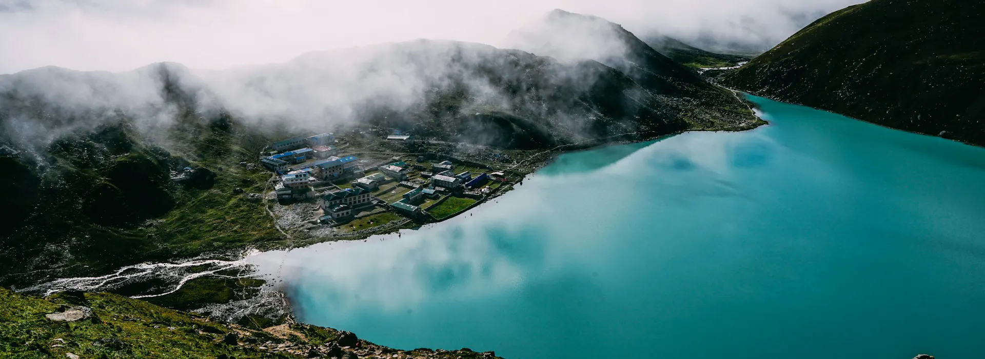
The gradual climb through Dole and Machhermo is to Gokyo Village (4750m / 15584ft). The settlement is located near the Gokyo lakes and this is surrounded by tall peaks and the Ngozumpa Glacier. Much of the trip is in a changing landscape from lower forest-covered trails to open valleys, to rocky paths and to glacial terrain.
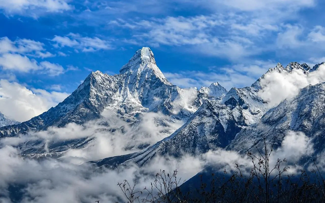
Its biggest attraction is the ascent to Gokyo Ri (5,357 m / 17,575 ft.). View of Lhotse, Makalu, Cho Oyu and other Himalayan summits from the viewpoint. It’s also possible to see across the Gokyo Lakes and Ngozumpa Glacier from the top. This hike is a steep one, so it is important to take your time and find your pace.
The Gokyo Ri Trek route also features a day of acclimatization in the town of Namche Bazaar, where the body gets a chance to acclimate to the higher altitudes before setting off on the trek. For those who are well acclimatized and trekking the day is not too long, an optional excursion to the Fifth Lake is available.
The trip back passes over Renjo La Pass (5360 m / 17585 ft) and then heads back down towards Lungden and Thame. In this section, there is a high mountain pass and a lesser-known portion of the Khumbu. The trek from Namche back to Lukla follows the same route.
The Gokyo Ri Trek is suitable for first-timers as long as they’re well fit, dressed appropriately and educated on altitude. The Gokyo Ri Trek is a trek with a number of long days of walking, so if you can get into the habit of doing some walking before you head to the trek, it will be beneficial. However, if the route is planned well, paced slowly and taken in a safe way with a good team, it can be done safely and comfortably. Nomad Adventure Treks can help arrange permits, transportation, guides, porters, accommodation and more for a journey.
Trip Highlights
- Gokyo Ri viewpoint at 5357 m / 17575 ft that has a wide view of Everest, Lhotse, Makalu and Cho Oyu.
- A set of glacial lakes high up in the Himalayas: Gokyo Lakes.
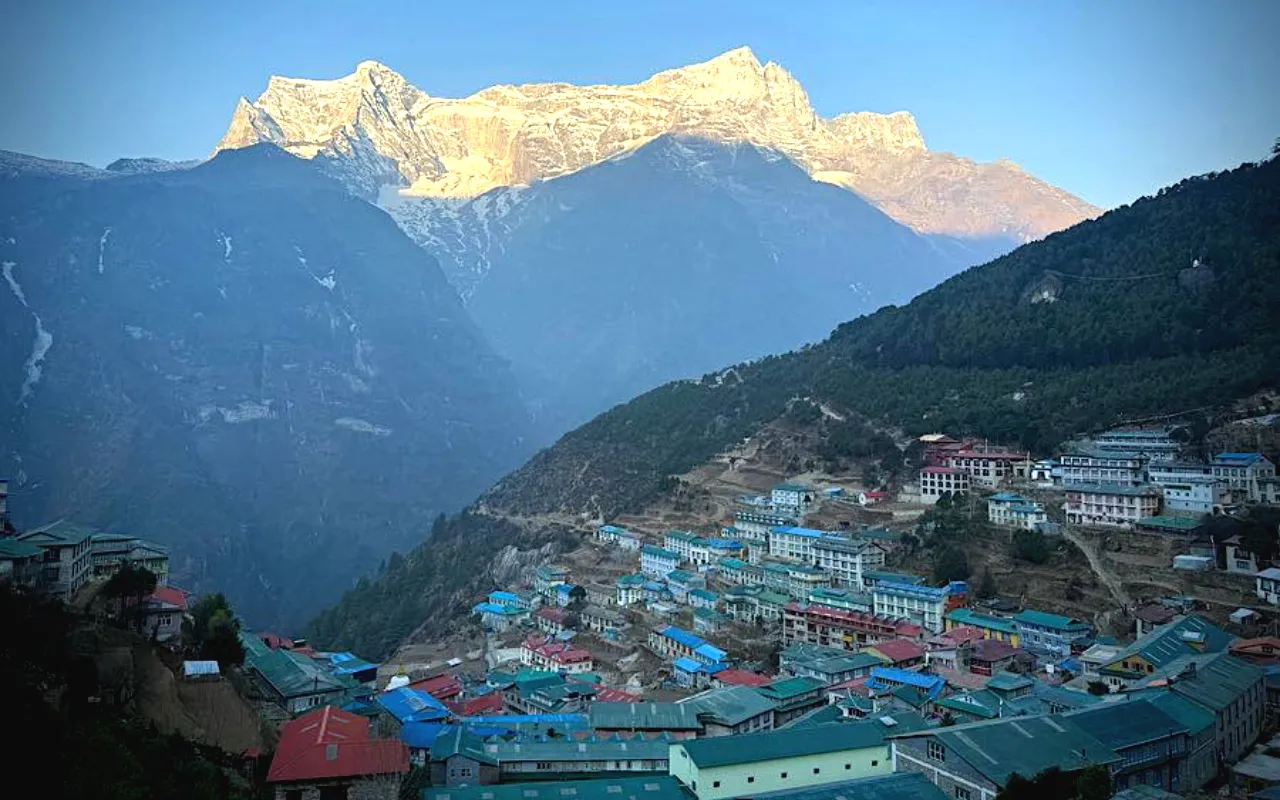
- A vibrant Sherpa town and acclimatization hub, Namche Bazaar.
- Scenic airplane flight from Kathmandu to Lukla with a view of the Himalayan landscape.
- Strolling next to the longest glacier in the Himalayas – the Ngozumpa Glacier.
- On the way back, crossing Renjo La Pass (5360m/17585ft).
- Visiting ancient Sherpa villages, such as Dole, Machhermo, Thame and Lungden.
- For the experienced trekker, there is a possibility of an optional hike up to the Fifth Lake.
- Slowly up and down from lower forest to rock-strewn valleys and high mountain areas.
- Enjoying the life of the locals, Buddhist culture, sojourns in a teahouse and the hospitality of the Sherpa people.
Detail Itinerary of Gokyo Ri Trek

Day 01: Flight to Lukla (2,843 m / 9,327 ft) and Trek to Phakding (2,640 m / 8,661 ft)
It starts with a short flight from Kathmandu towards Lukla, which is approximately 35km away. The duration of the flight is approximately 35 minutes but may be subject to change due to weather and air traffic conditions. On arrival at Lukla, you’ll meet the trekking group and get ready for the first trek.
The path slopes down from Lukla to the Dudh Koshi River. Small mountain villages, local farmland and forest areas will pass before arriving in Phakding. The first walking day is fairly short and is a good time to get used to the pace of the walk.
Overnight accommodation is in Phakding in a teahouse.

Activity: Flight to Lukla and trekking to Phakding, 3 to 4 hrs

Max. Altitude: 2,843m/9,327ft. Lukla

Meal: Breakfast, Lunch, Dinner

Accommodation: Teahouse
Day 02: Trek from Phakding to Namche Bazaar (3,440 m / 11,286 ft)
Following breakfast, the path goes along the Dudh Koshi River to Namche Bazaar. The villages are linked by several suspension bridges, with forested areas and gentle slopes between villages.
From Monjo, it is a drive into Sagarmatha National Park, finalizing all the formalities required for park entry. The track then goes through Jorsalle to the Hillary Bridge. Once the bridge is crossed, the road steeply rises and climbs through pine and rhododendron forest towards Namche.
The final uphill section is a bit more difficult due to the increase in altitude. Namche Bazaar is a thriving Sherpa community and a vital acclimatisation point. The night will be spent in a teahouse in Namche.
Activity: Trekking from Phakding to Namche Bazaar, 5 to 6 hrs
Max. Altitude: 3,440m/11,286ft. Namche Bazaar
Meal: Breakfast, Lunch, Dinner
Accommodation: Teahouse
Day 03: Acclimatization Day in Namche Bazaar
It’s a day for acclimatization. You will not be inactive but will gradually walk up to be above Namche and back to the same village for a comfortable sleep. This assists the body’s adaptation to higher altitudes while not getting overly strenuous.
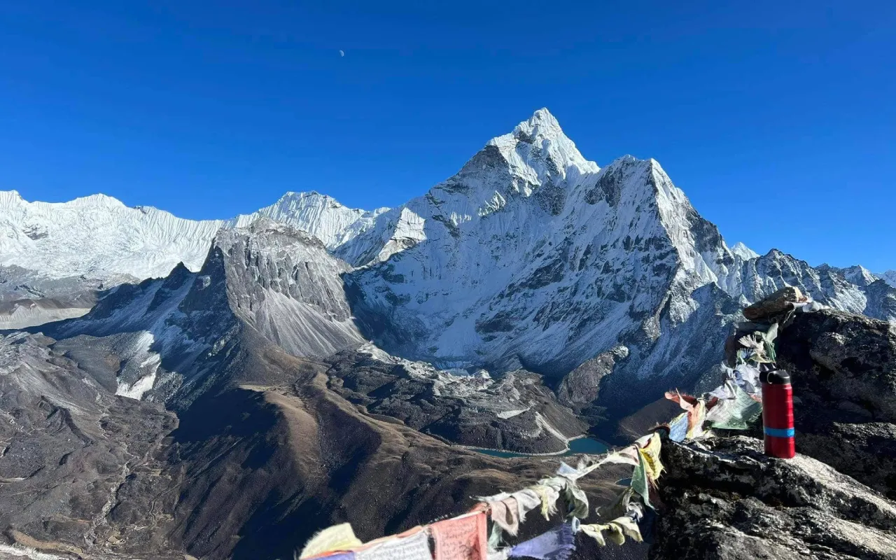
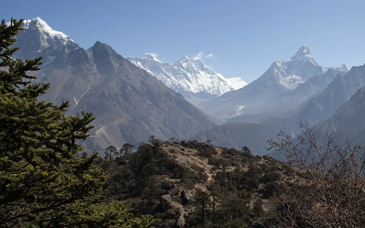
The typical route climbs after breakfast towards Sagarmatha National Park Museum, where it leads on a further uphill trek towards Hotel Everest View in Syangboche. The viewpoint offers a great view of Everest, Lhotse, Nuptse, Ama Dablam, Thamserku, Kongde Ri and Khumbila and reaches at around 3,880m / 12,730ft. The entire journey takes approximately 5-6 km and 3-4 hours.
Trekkers who are at ease can continue to the Khumjung Village. The night will be in Namche.
Activity: Acclimatization hike to Everest View Hotel, 3 to 4 hrs
Max. Altitude: 3,880m/12,730ft. Hotel Everest View
Meal: Breakfast, Lunch, Dinner
Accommodation: Namche Bazaar
Day 04: Trek to Dole (4,200 m / 13,780 ft)
The trek from Namche Bazaar goes upwards to Kyangjuma, then on to Mong La. On the way further into the upper Khumbu, views are of Ama Dablam, Thamserku and Kangtega.
The trail then heads down through rhododendron and birch woodland to Phortse Tenga beside the Dudh Koshi River from Mong La. Following a brief ascent, there is a steady climb through the woods again after a short break.
As you ascend, you find that the vegetation becomes sparser and eventually you end up in Dole (4,200 m / 13,780 ft). There are a number of hill and flat sections during the day and staying at a comfortable pace is important. Dole is a small town with teahouses to spend the night.
Activity: Trekking from Namche Bazaar to Dole, 5 to 6 hrs
Max. Altitude: 4,200m/13,780ft. Dole
Meal: Breakfast, Lunch, Dinner
Accommodation: Teahouse
Day 05: Trek to Machhermo (4,470 m / 14,665 ft)
From Dole, the trail proceeds slowly up at a moderate incline through the upper reaches of the Gokyo Valley. The forest is behind and there are more open spaces and rocky slopes where yaks are grazed in the lower altitude areas.
You will cross Lhabarma and Luza before proceeding along the hilltop above the Dudh Koshi Valley. The view of Cho Oyu, Thamserku and Kangtega becomes more pronounced with the increase in the elevation of the trail.
Machhermo (4470 m / 14665 ft) is where you would be able to find several teahouses for trekkers. The walk should now be slow and steady as the elevation is much higher. It is helpful to take breaks and drink plenty of water in this part of the journey.
Overnight stay in a teahouse in Machhermo.
Activity: Trekking from Dole to Machhermo, 4 to 5 hrs
Max. Altitude: 4,470m/14,665ft. Machhermo
Meal: Breakfast, Lunch, Dinner
Accommodation: Teahouse
Day 06: Trek to Gokyo (4,750 m / 15,584 ft)
The trail heads north from Machhermo into the upper Gokyo Valley. It then moves through Pangka and around the Ngozumpa Glacier, passing through an ever more open landscape. The trail continues to follow a slight ascent and rocky sections start to increase as you approach Gokyo.
As the valley clears, one can see more of the surrounding mountains. Then, you can follow a trail through the scenery of glaciers until you get to Gokyo Village, located next to the Gokyo Lakes. The village is nestled in high mountain slopes and is located at an altitude of about 4,750 m / 15,584 ft.
The distance may not seem like that much but the hike is a tough one due to the elevation. Don’t rush into things and don’t worry about feeling overwhelmed; take time and get used to it.
You will spend the night at a teahouse in Gokyo.
Activity: Trekking from Machhermo to Gokyo, 4 to 5 hrs
Max. Altitude: 4,750m/15,584ft. Gokyo
Meal: Breakfast, Lunch, Dinner
Accommodation: Teahouse
Day 07: Hike to Gokyo Ri (5,357 m / 17,575 ft)
The early morning climb to Gokyo Ri is recommended. The path from Gokyo Village slopes upwards quickly through rocky terrain to reach the top. It is a challenging climb due to its elevation and must be done slowly and steadily.
From Gokyo Ri (5,357 m / 17,575 ft), you can witness several majestic Himalayan peaks such as Everest, Lhotse, Makalu and Cho Oyu. Below, also visible are the Gokyo Lakes and Ngozumpa Glacier. The standard Gokyo Ri round trip is approximately 6km and takes around 3 to 4 hours.
Once up at the top, you will head down again to Gokyo for a rest. With proper acclimatization, trekkers may choose to walk the longer alternative path to the Fifth Lake. This extension is approximately 16 km in total, which will take 6-8 hours.
Activity: Gokyo Ri summit hike and optional Fifth Lake excursion, 3 to 4 hrs
Max. Altitude: 5,357m/17,575ft. Gokyo Ri
Meal: Breakfast, Lunch, Dinner
Accommodation: Teahouse
Day 08: Trek to Lungden via Renjo La Pass (5,360 m / 17,585 ft)
The trip to Gokyo will be early and you will then follow the side of the Gokyo Lakes before making the long ascent towards Renjo La Pass. It is rocky and open, with the trail steepening as it heads towards the pass.
The highest point of today’s trek is Renjo La (5,360 m / 17,585 ft). From the pass, in clear weather, Everest, Lhotse, Makalu, Cho Oyu and the other ranges of the Himalaya can be seen. Gokyo Valley and lakes are there in the background.
After crossing the pass, the trail plunges steeply and carefully into the Bhote Koshi Valley. The descent from Renjo La to Lungden (1010 m / 3314 ft) and you will continue to Lungden (4,350 m / 14,272 ft) and spend the night there.
Activity: Trekking and Renjo La Pass crossing, 7 to 8 hrs
Max. Altitude: 5,360m/17,585ft. Renjo La Pass
Meal: Breakfast, Lunch, Dinner
Accommodation: Teahouse
Day 09: Trek to Namche Bazaar (3,440 m / 11,286 ft)
It is a long descent through the Bhote Koshi Valley to start the day. The trail from Lungden goes through Marlung and then to Thame, a typical Sherpa village that is linked to the upper Khumbu. Alternatively, if time and energy permit, you can take a short break or visit Thame Monastery.
It then flows downstream from Thame along the banks of the Bhote Koshi River. Forests of pines and rhododendrons become more prevalent and at lower elevations there are a couple of small villages along the way.
The trail eventually heads back to the road towards Namche Bazaar. The walk is approximately 18 kms long and the overall duration is 6 to 7 hours. Most of the day is downhill but after crossing Renjo La, the long distance can be tiring.
Overnight accommodation is in a teahouse in Namche Bazaar.
Activity: Trekking from Lungden to Namche Bazaar via Thame, 6 to 7 hrs
Max. Altitude: 3,440m/11,286ft. Namche Bazaar
Meal: Breakfast, Lunch, Dinner
Accommodation: Teahouse
Day 10: Trek to Lukla (2,843 m / 9,327 ft)
The final day of the trek is spent on the same route as the day from Namche Bazaar to Lukla. You’ll be going through the Sagarmatha National Park, through the village of Jorsalle, Monjo and Phakding and then on to the Dudh Koshi Valley.
It is an interesting trail with several suspension bridges and some forested areas, village paths and gentle inclines. While a lot of the path drops down, the last stretch to Lukla is up a hill.
The walk is about 18 km and would normally take 6-7 hours. This is a long day at the end but it’s time to reach Lukla and the trekking part of the journey is over. Rest and time will be spent with the trekking crew.
There is a teahouse in Lukla for overnight accommodation.
Activity: Trekking from Namche Bazaar to Lukla, 6 to 7 hrs
Max. Altitude: 2,843m/9,327ft. Lukla
Meal: Breakfast, Lunch, Dinner
Accommodation: Teahouse
Day 11: Flight to Kathmandu or Ramechhap
Following breakfast, you’ll get ready to board the return flight from Lukla. The duration of the flight is typically about 35 minutes but it may vary due to weather and air traffic conditions in the Everest region.
Depending on the operating conditions and flight schedule, you can fly directly to Kathmandu or to Ramechhap Airport. Road transfer to Kathmandu from Ramechhap.
From Kathmandu, you will be met by a vehicle to get you to your hotel. The remainder of the day will be free for rest following the trek. Alternatively, you may use the time to tidy up your belongings, or to get ready and unwind before travelling onwards.
The Everest Gokyo Lakes trek ends on this flight.
Activity: Flight from Lukla to Kathmandu or Ramechhap and hotel transfer, 35 min flight
Max. Altitude: 1,350m/4,429ft. Kathmandu
Meal: Breakfast
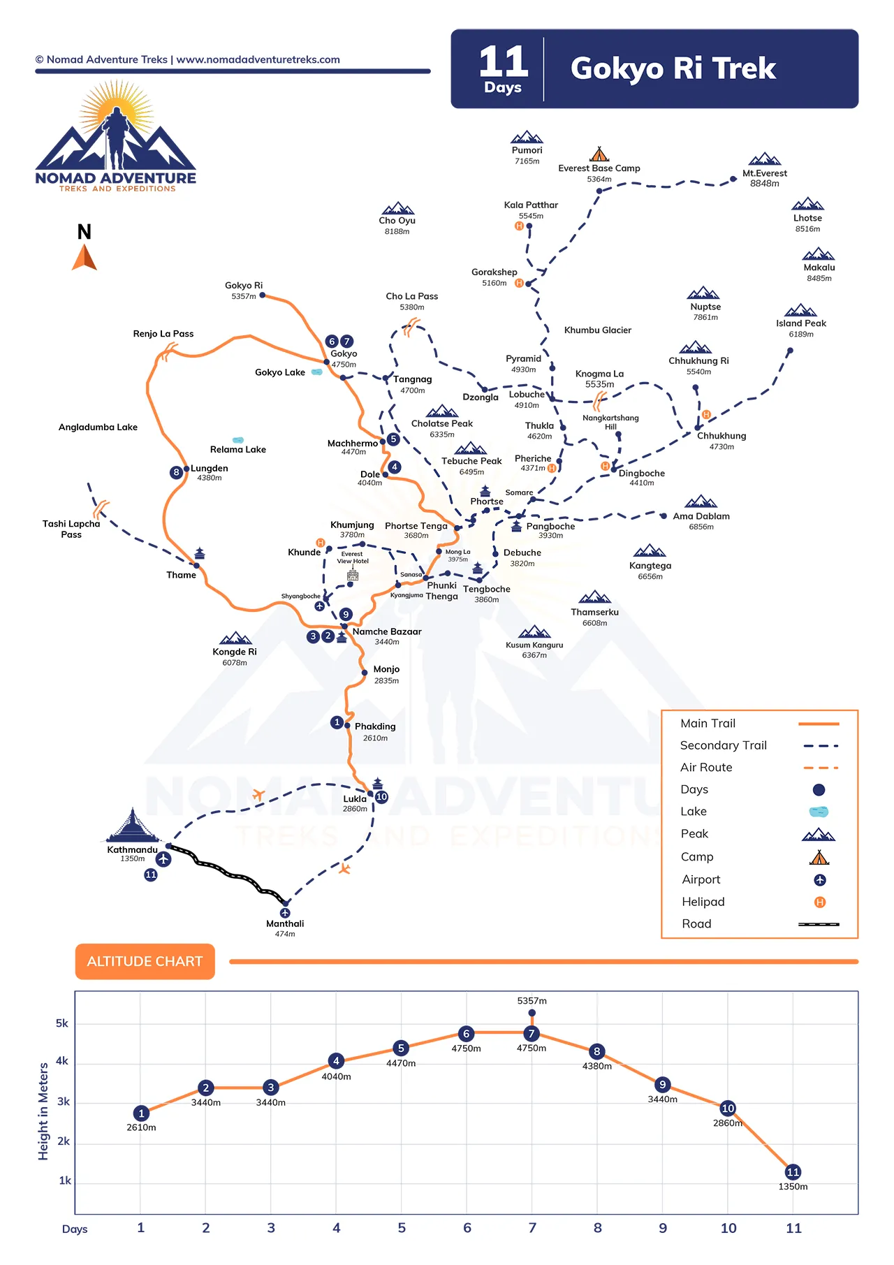
Trip Route Map
Includes & Excludes
What are included with package?
Accommodation
- Accommodation at the teahouse on a twin-sharing basis during the trek.
- A tour guide to lead the trek (included in package)
Meals & Drinking Water
- One night’s accommodation and breakfast at the base camp while trekking.
- Package-specified drinking water
Transportation
- The domestic flight from Kathmandu or Ramechhap to Lukla.
- Airport transfers as mentioned in the package
- Ground transportation during the itinerary is required.
Guide and Staff
- Experienced licensed trekking guide
- Porter, support staff as per package.
- Guide and staff expenses, including their meals and accommodation
Medical Assistance
- Basic first aid support on trek.
- Support in medical issues from the guide
- Coordinating emergency evacuation if needed
Permits
- The entry permit to see Sagarmatha National Park is a must-have.
- Permit from Khumbu Pasang Lhamu Rural Municipality.
- Local trekking permits for other required treks.
Benefits and Takeaways
- Trekking route guidance and co-ordination
- Acclimatization support of trekking team
- Assistance throughout the trekking journey
- Local teahouse arrangements (available)
Administrative & Taxes
- Government taxes related to included services
- Normal administration and service fees
- Company service costs related to the agreed itinerary
What are not included with package?
- International airfare
- Nepal tourist visa fee
- Travel insurance
- The cost of high altitude rescue and helicopter evacuation.
- Individual health costs and medicines
- Extra snacks and drinks for individual consumption.
- Alcoholic beverages
- Tea, coffee, soft drinks and bottled water (other than the quantity supplied)
- Hot showers
- Wi Fi and internet charges
- The charging fee for electronic devices.
- Laundry services
- Personal shopping and souvenirs.
- Guide and porter tips and staff tips.
- Additional room and board due to flight cancellations or changes in itinerary.
- Meals and/or other travel beyond the scheduled round trip
- Any weather, natural or other unforeseen expenses
- Any service that is not listed under the inclusions.

Note:
If you have a private group and prefer a personalized experience, we can organize a custom trip tailored to your requirements and group size, running it any day you choose.
Detail Information about Gokyo Ri Trek
Weather and Best Season
Weather varies greatly along the Gokyo Ri route as altitude and season change. The trekking conditions are normally stable from March to May; the temperatures are moderate and the mountain visibility is good. September to November is another good time of year, as the skies are clearer and the trails aren’t as muddy.
| Season | Daytime Conditions | Night Conditions | Trekking Conditions |
| Spring | Mild to cool | Cold | Good, with blooming rhododendrons |
| Summer/Monsoon | Warm at lower elevations, wet | Cool | Rain, clouds and slippery trails |
| Autumn | Mild and clear | Cold | Excellent visibility and generally dry trails |
| Winter | Cold | Very cold | Snow and freezing conditions at higher elevations |
In winter, it can become really cold around Gokyo and Gokyo Ri with temperatures often dropping below freezing point. Monsoon may cause clouds and rain and flight delays. Be sure to monitor the current weather conditions before leaving.
Difficulty and Altitude Sickness
The Gokyo Ri Trek is moderately challenging and a high-altitude trek. The biggest challenge is the long walking hours, the steep inclines, the rocky path and the decreasing amount of oxygen at higher altitudes. The ascent to Gokyo Ri is 5357 m/17575 ft, which makes it very important to acclimatize.
Common challenges include:
- Steep uphill sections
- Long walking days
- A rough and bumpy surface
- Cold conditions at higher elevations
- Loss of interest in food and fatigue
- Possible symptoms of altitude sickness
A slow pace combined with frequent water intake and acclimatization will minimize the risk. These are symptoms that should never be ignored: headache, dizziness, nausea, unusual weakness, or difficulty breathing. When symptoms worsen, it’s best to get down to a lower level.
Insurance, Visa and Permit
Travel insurance is highly recommended for the Gokyo Ri Trek. In addition to the above, a policy needs to include high altitude trekking and emergency evacuation (including helicopter evacuation if medically required). Before buying a policy, verify the maximum height attained by the policy.
The minimum requirement for entry into Nepal is a valid passport and a proper Nepal tourist visa unless the person is eligible for visa free entry in Nepal. Please note that visa requirements may differ depending on the nationality of the traveller; please refer to the current visa requirements before travelling.
The hike also requires the appropriate local and national park permits. In order to visit the Everest region, a permit to enter Sagarmatha National Park is needed. An entry permit of Khumbu Pasang Lhamu Rural Municipality is also needed. Nomad Adventure Treks can help arrange the necessary trekking permits and arrangements.
Health and Safety
With proper preparation, the Gokyo Ri Trek can be a safer and more comfortable experience. It is expected to walk for several hours on back-to-back days and to manage normal up hills. Walking, stair climbing and moderate cardiovascular activity training prior to the journey can be helpful.
Important safety points:
- Walk slowly, especially above 3,000 m / 9,843 ft.
- Drink water regularly.
- Don’t drink alcohol during acclimatization.
- If you are feeling unwell, inform your guide.
- If symptoms of altitude sickness get worse, don’t keep going.
- Keep warm during mornings and nights.
- Bring simple personal medication and first aid kit.
- Take your guide’s advice during hard times!
Mountain conditions can rapidly change, so always have the right clothing and equipment on hand.
Transportation
Kathmandu is the typical base from which to begin the Gokyo Ri trek. Trekkers usually fly a short distance from Kathmandu to the base of Lukla, the primary point of access to the Everest region. Typically, it takes approximately 35 minutes to fly in normal conditions.
Weather and air traffic may impact flight operations. If there is a high demand for the flights, they can be operated from Ramechhap Airport instead of Tribhuvan International Airport, Kathmandu. If this is the case, an extra road transfer is necessary from Kathmandu to Ramechhap.
After reaching Lukla, the rest of the trek is done on foot. Luggage and route management can be done with the assistance of the local porters and guides. Nomad Adventure Treks can organize the required transport and trekking equipment.
Your Extra Expenses
Normally this includes the primary trekking services but you should bring a bit of extra cash for your own needs. The cost may be different based on your choice and further use of services on the trail.
Typical personal expenses:
- Drinking water in bottles or filtered water.
- Teas, coffee and soft drinks.
- Snacks and chocolate
- Hot showers
- Wi Fi services
- Charging electronic devices
- Personal medicines
- There are a few tips for guides and porters:
- Additional lodging and/or transport due to delay(s)
- Personal shopping, souvenirs
A cash facility is valuable as many rural regions lack facilities for using cards. Before going towards the higher parts of the route it is better to bring sufficient Nepalese rupees from Kathmandu.
Language and Communication
Nepali is widely used in the Everest region and Sherpa is widely spoken by the local communities. Many guides, lodge staff and those involved in tourism understand English as well.
On the Gokyo Ri Trek, it is easier to communicate with short and clear sentences. Your guide will be able to assist in talking to the teahouse staff and making arrangements for services throughout the journey.
You might also want to learn some key words for Nepali to aid in the flow of everyday communication. Simple words like “Namaste” for greetings, “Dhanyabad” for thank you and “Pani” for water are helpful.
Other local languages and dialects might also be heard in villages. Along the main trekking route, the communication is generally easy, as tourism has been an important part of the economy for many years.
Mobile Network, Internet and Charging Facilities
Mobile reception works in parts of the Everest region but is not reliable all the time during the Gokyo Ri Trek. In remote areas, coverage is weaker and in some areas, coverage is absent.
Larger villages usually have teahouses with Wi-Fi. The internet may be slow, especially if there are a lot of trekkers on the same network. Connectivity can also be impacted by weather and local conditions.
Many teahouses provide electricity and it can cost more to charge in higher areas. Always have a portable battery or a power bank to keep your phone, camera and other devices charged. It’s also a good idea to have a universal travel adapter.
Avoid using mobile internet as a main navigation tool or for emergency calls. Have essential information stored outside of the internet.
Don’ts on this Trip
Respecting the local communities and responsible trekking is significant for the whole Gokyo Ri trek. The route traverses villages, monasteries, protected areas and environmentally sensitive mountain habitats.
The following are things to avoid:
- Please do not litter on the trail.
- Avoid harming plants or property.
- Do not enter the monasteries without permission!
- Avoid taking photos of individuals without their consent.
- Don’t ignore the symptoms of altitude sickness.
- Avoid speeding on steep slopes.
- Avoid water wastage in villages far from town.
- Never leave batteries or other waste.
- Do not disturb wildlife.
- Avoid straying from the trail unless accompanied by another person.
These are simple steps to take which will help to preserve the route and display respect for the communities that reside along it.
Cultural Festivals on the Trail
Sherpa Buddhist culture prevails in the Everest region and the festivals here offer an insight into the culture of the communities along the trekking route. The festival dates are based on the lunar calendar of Tibet and vary from one year to the next.
Mani Rimdu is of special significance in the Khumbu region. This is celebrated in the monastery of Tengboche where, together with Buddhist prayers and rituals, masked dances and community gatherings are also performed. The festival is typically held between October and November, according to the lunar calendar.
There are other Buddhist festivals and local festivals in the villages of the broader Everest region. Your guide will be able to advise you on the correct way to behave if your Gokyo Ri Trek falls during a festival and if it is appropriate to attend ceremonies.
Respect religious activities and abide by local rules at monasteries.
Tips for First-Time Visitors
With a bit of preparation, the Gokyo Ri Trek can be very easy for novice trekkers. There are a number of long walking days on the route, so it is helpful to get comfortable with walking before you head to Nepal. Trekking shoes that are comfortable should be broken in before the trip.
Helpful tips include:
- Practice frequently before coming.
- Pack layers, not one big jacket.
- Bring a water bottle that you can refill.
- Have sunscreen, sunglasses & lip balm available.
- Take a power bank for off-the-grid locations.
- Have some Nepalese currency on hand.
- Follow a gradual walking pace.
- Provide sufficient acclimatisation time.
- Pay attention to your guide’s instructions.
- Pack essential medicines in the daypack.
The Gokyo Ri Trek is a route that has a lot of elevation gain, so it will be more helpful to take it slow rather than speed it up. With good preparation, sensible pacing and paying attention to how you feel you’ll enjoy the route safely.
What Makes Gokyo Ri Different from Everest Base Camp?
The Gokyo Ri Trek is also in the Khumbu area but differs from the Everest Base Camp Trek in terms of the route taken and the experience offered. Gokyo is located around the Gokyo Lakes, the Gokyo Ri and the Ngozumpa Glacier and the Everest Base Camp trek heads towards the base camp and Kala Patthar.
| Feature | Gokyo Ri Trek | Everest Base Camp Trek |
| Main viewpoint | Gokyo Ri | Kala Patthar |
| Highest point | Gokyo Ri, 5,357 m / 17,575 ft | Kala Patthar, about 5,644 m / 18,517 ft |
| Main attraction | Gokyo Lakes and Ngozumpa Glacier | Everest Base Camp and Khumbu Glacier |
| Major pass | Renjo La, 5,360 m / 17,585 ft on this itinerary | No high pass on the standard route |
| Route character | Lakes, glacier, high valleys and quieter sections | Villages, monasteries, base camp and busy main trail |
| Optional extension | Fifth Lake | Kala Patthar |
Gokyo can be a viable option if one is looking for trekking alternatives that includes lakes, glaciers and a high mountain pass.
A Day in Gokyo Village
Gokyo Village is located next to the Gokyo Lakes at approximately 4750m / 15584ft. Once in the village, most hikers take the time to acclimatize to the elevation and not start another challenge.
One afternoon might be spent strolling around a local lake, shooting photos or sitting in the teahouse. The area surrounding the village is very different from the forested areas lower in the valley and the rocky slopes and surrounding glaciers and high peaks can be seen.
It is typically a subdued night. Trekkers usually pack their bags and their clothes for an early morning ascent of Gokyo Ri after dinner. It is important to get sufficient rest on the night before the hike, as the hike the next day starts early and is a steep one.
The village also gives you a chance to taste the life of a remote Himalayan village before heading up to the high mountain trails.
Optional Fifth Lake Hike: Is It Worth Adding?
A long walking day and fifth lake is an option for well acclimatized/hikers comfortable with a long day. From Gokzhi follows the path northwards along the Ngozumpa Glacier to the more remote area of the upper valley.
The journey takes about 6 to 8 hours, depending on path conditions, rest stops and walking speed and is about 16 km in one direction. The ground is rocky and open, so the hike is more challenging than a quick exploration around Gokyo Village.
The views towards Cho Oyu and other peaks of the Himalayas are towards Fifth Lake or Ngozumba Tsho. If you have the energy and desire to travel further into the upper Gokyo Valley it’s a worthy consideration.
Does not need to be completed on the main trek. If you feel tired or are experiencing altitude-related symptoms, please don’t take the extension; merely rest and acclimatize.
Frequently Asked Questions
Can people who have never been to the Himalayas do the Gokyo Ri Trek?
Yes. This trek is suitable for first-timers in the Himalayas, as long as they are reasonably fit, well acclimatized and have proper equipment with an experienced trekking team.
Is there any way I can add the Fifth Lake in without altering the main route?
Yes. Optional excursion from Gokyo can be made to the Fifth Lake, which takes about 16 km and 6-8 hours.
Does this Gokyo Ri route include Renjo La Pass?
Yes. This route crosses Renjo La Pass at 5 360 m / 17 585 ft on the way down to Lungden then passes the next pass (5 390 m / 17 685 ft) to Thame.
What's the peak on the main Gokyo trail?
Gokyo Ri reaches 5,357 m / 17,575 ft, while Renjo La reaches 5,360 m / 17,585 ft during the return section.
How early should I start the Gokyo Ri climb?
Early morning is suggested, as this is a steep climb with height increasing throughout the day.
May I stop in Thame when travelling back?
Yes. After Lungden, the route goes through Thame, where there is a short stop and the opportunity for a visit to Thame Monastery.
Is there an acclimatization point on the way to Gokyo?
Yes. A few days into the trip, the group will be in Namche Bazaar, where they will spend a day acclimatising themselves with a gradual trek to the Everest View Hotel.
How does this trek accommodate accommodation?
The main accommodation along the route is in teahouses, twin-sharing rooms and the basic facilities are fit for high altitude trekking.
Are flights to and from Lukla affected by the weather?
Yes. Weather and air traffic conditions are critical for the flight to Lukla, so flights may be delayed, cancelled, or rescheduled.
Can you explore Gokyo Village after your arrival?
Yes. Trekkers can relax, take strolls around the lake, take photos and get ready for the early Gokyo Ri trek.
Related Blog and Articles
Reviews on Gokyo Ri Trek
 Write a Review


- Your safety, our no 1 priority
- Best price guarantee
- Experienced & dedicated team
- Easy booking, no hidden charge
- You can customize this trip
Talk to Travel Expert
Samundra Rimal (+977-9843127084)
Related trips you may like